History/City Profile
HISTORY OF BALI

Bali is an ancient city. A Jain scroll which Colonel James Tod obtained from a Jain guru in Sanderao gives the earliest description of founding of Bali town. The scroll mentions that on the sack of Vallabhi city in Gujarat, thirty thousand Jain families abandoned Valabhi and led by their priests found a retreat for themselves in Marwar, where they erected the towns of Sandrao, Bali and Nadol in 524 AD.[1] It was the heart of the Godwar area in the 11th century. It was also a town where regular horse fair was held to trade the horses. King Sarubali Baldev won the land of Bali in a battle in 1240 AD and he crowned the area his royal capital, naming it Bali after himself. Legends say that the Pandava children used to play childhood games in this area and a water well still exists which was formed by Bhima, one of the Pandavas. In 1608 AD King Balasingh constructed the Fort of Bali to protect the city and a wall was built around the city edges to protect it from attack. The town planning is based on ancient geometrical, astrological and architectural laws. The marriage of Rana Udai Singh, father of legendary hero Maharana Pratap, was solemnized with the daughter of the Rao of Jalor at Bali.[1] A dispensary was established in this town in March 1896. In 1897, it served 17 in-patients and 4166 out-patients and 318 operations were performed in it.[2] In 1900 there was a plague outbreak in town and the town was evacuated. 1245 deaths occurred during the month of January 1900 as a result of diarrhoea, dysentery andpneumonia. Prior to formation of Rajasthan it was headquarters of a district with same name in erstwhile Jodhpur state. Bali had its own municipality even before independence. It had a middle school in 1932 that was upgraded to high school and in 1946 had more than 200 pupils. In 1960 Bali had three primary schools for boys, one primary school for girls and a high school. The telephone arrived in Bali in 1957, it got electricity in 1961 and piped water connections were given in 1970. A tehsil library was established in the center of Bali in Bawari Jav in 1958. In addition Bali also has a Jain library.
in bali village one of faumus sirvi aai mata hindu temple

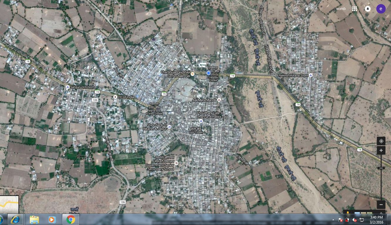
Bali is located at 25.18°N 73.28°E[3] near the Aravalli Range. It is a constituency of Pali district. It has an average elevation of 298 metres (977 feet). In the east it has Aravali Hills and fort of Kumbalgrah is visible from Bali. In the north it has two rocky Hillocks where temples of Hinglaj Mata and Dantiwara are located respectively. The Mithari river is seasonal and flows only during the rainy season.
The nearest railway station on the network of Indian Railways to reach is Falna,which is 7 km from Bali. The nearest airport is Udaipur.
Administration
Bali is represented in the center under Pali (Lok Sabha constituency), while in state it is represented under the Bali (Rajasthan Assembly constituency). Present MLA is Mr. Pushpendra Singh Ranawat. It is a municipality of class IV. There are 20 wards for the municipality. Presently Bali has BJP board and Chairperson is Mr. Lakhmaram.

Demographics
As of 2011 India census,[4] Bali had a population of 19,880. Males constitute 50.67% (10,007) of the population and females 49.33% (9,873). Bali has an average literacy rate of 64.28%, lower than the national average of 74.04%; with 74.51% of the males and 53.91% of females literate. 11.72% of the population is under 6 years of age. In 1897 its population was about 6000.[5] The majority of population of Bali consists of Jain and Marwadi community, which is also the most prosperous community. However most members of this community have settled elsewhere in India, where they carry out business and visit their ancestral town mostly to perform marriages in the family.
The Bali Assembly constituency is one of the six Rajasthan Legislative Assembly constituencies in Pali district. In the past, it has also elected the former Chief Minister Bhairon Singh Shekhawat as their MLA in 1993 and 1998.[6]
| Demographic distribution of religions in Bali | ||||
|---|---|---|---|---|
| Hinduism |
|
82% | ||
| islam |
|
13% | ||
| Jainism |
|
3.7% | ||
| Others♦ |
|
1.3% | ||
| ♦Includes 0.4% Christians and 0.2% Sikhs | ||||
Population growth through the years
As a tehsil
Bali tehsil has 93 villages under 39 gram panchayats and two municipalities, Falna and itself. Gram Panchayats are Amaliya,Barwa, Bedal, Bera, Bhandar, Bhatund, Bheetwara, Bhimana, Bijapur,sela, Bisalpur, Boya, Chamunderi, Dhani-Sela, Doodni, Falna Gaon, Goriya, Guralas, Kakardi, Khimel, Kotbaliyan, Kothar, Koyalwao, Kumtiya,sandla, Kuran, Latara, Lunawa, Lundara, Malnoo, Mirgeshwar, Mokampura, Mundara, Nana, Paderla, Peepla, Perwa, Sena, Sesli, Sewari and Shivtalao.[7][8] The tehsil has an area of about 1304.26 square kilometres.[9]
Population of the tehsil is 2,23,027 (2001 census). Out of which 1,83,802 is rural while 39,225 is urban. Male constitutes 1,11,572 and female population is 1,11,455.[10] The tehsil has a good population of tribes. " The main education school is Govt High Secondary. the School provide science, commerce and art stream education. A government science college was established here in 2013." "The Fabindia School" was established here in 1992, which is today a co-educational, senior secondary school with 1000 students including 40% girls.[11] Ms Deepika Tandon is the head of the institution.